Dick Durward, Area Resident since 1920, Has Passed Away

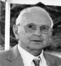
Dick Durward

Long-time area resident Richard “Dick” Durward passed away this last Saturday, at his home in Tumwater. Local historian, author, and Griffin Neighborhood Association Board member Steve Lundin brought this to our attention. Writes Steve, “The Durwards moved to the Griffin area in the early 1920s when Dick was about two.  They lived on Fredricks’ hill, which is the steep hill you drive down before you get to [the 2300 block of  Gravelly Beach Loop].  Dick was the first fire chief of the newly formed Griffin fire district in the 1960s, as well as the Grand Master of the Prosperity Grange.  He operated a saw shop out here in the 1960s — it where the used furniture store is on Sexton Road.” Dick attended the Griffin School.

The Olympian has published an obituary of some respectable length. Click here for that page. And, KOMO4 has an obituary, on their web site. Click here to browse that page.

Service Information:

Friday November 19th 2010 12:00pm
Mills and Mills Funeral Home and Memorial Park
Tumwater, WA

Steve Lundin has authored a number of articles for this blog, regarding the history of the Griffin area.

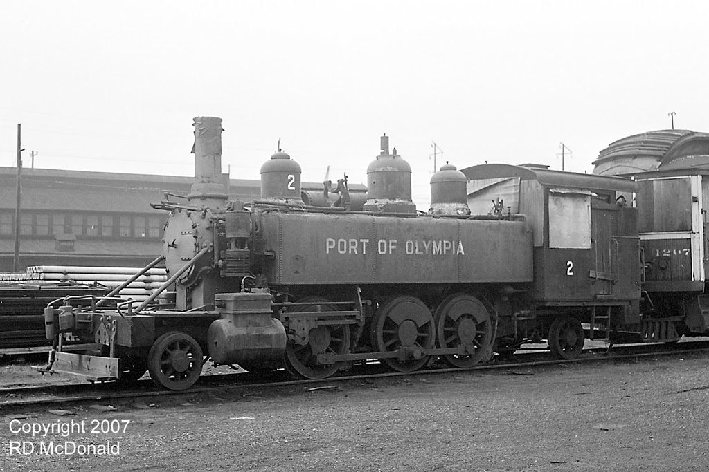
Griffin Area Logging Railroads

Three different logging railroads served the greater Griffin area many years ago.

These railroads are discussed in Gone But Not Forgotten – Abandoned Railroads of Thurston County, Washington, written by Dr. James Hannum, a resident of our community.

The Puget Sound and Chehalis Railroad was the first railroad. It was also known as the Mosher and McDonald Railroad and then the McCleary Timber Company Railroad. The railroad had 12 miles of track terminating on Mud Bay at the current address of 2144 Madrona Beach Road NW. This site is about 1.4 miles up Madrona Beach Road northwest of the park and ride lot on Mud Bay.

The railroad was constructed shortly after 1888. Soon after Henry McCleary purchased the railroad in 1906, the link to Mud Bay was abandoned after a connection was made from McCleary to the Northern Pacific Railroad. Logs were rolled into Mud Bay from a log rollway running parallel with the shoreline and then rafted to saw mills located on Puget Sound. Two switchbacks took the railroad up the hill around the Indian Shaker Church before the railroad began running westward to McCleary, generally south of what is now Highway 8.

The most remembered railroad serving the greater Griffin area was the Mud Bay Logging Company Railroad. Initially the railroad was called the Thurston County Central Railroad. It was constructed around 1906 and abandoned in 1941.

The Mud Bay Logging Company Railroad eventually had two mainlines totaling 35 miles. An extensive facility was located on Mud Bay where the park and ride lot is now located just east of where Perry Creek enters Mud Bay. Logs were hauled from the company’s logging operations, dumped into Mud Bay, and then rafted to sawmills on Puget Sound. Remnants of several piers may still be seen extending into the Bay north or the park and ride lot. A marker commemorating the facility is located at the northwest end of the park and ride lot.

The initial railroad ran southward from the terminus on Mud Bay, across the county right of way on what is now Madrona Beach Road, and up Delphi Valley on the west side of McLane Creek down to Waddell Creek. Short spurs snaked out from the mainline to serve areas where logging occurred. A branch line was built westward from its original line to serve the company’s operations in the north portion of the Black Hills. Again, a large number of short spur lines were connected to this new mainline.

Dr. Hannum indicates that a third railroad (the Jameson Logging Company Railroad) also served the greater Griffin area running into Summit Lake from the south. Not many records of this railroad remain. It appears to have been built around 1905. This railroad may actually have been a short section of the old McClearly Timber Railroad. A short history of Summit Lake includes a hand drawn map that shows the McClearly Railroad running westward from the northwest shore of Summit Lake and then parallel with Highway 8 toward McCleary.

Bill Durward recalls helping his father take the annual school census for Schneider’s Prairie School District in 1922 or 1923. They traveled by automobile up what is now Highway 8, parked on the side of the road, and walked up railroad tracks leading to company houses on Summit Lake. Presumably there was no auto road leading to the Lake at that time. The northern portion of Summit Lake was located in Schneider’s Prairie School District and remains part of the Griffin School District. Bill recalls the railroad as being called the McCleary Timber Company Railroad. The short connection to Summit Lake probably was soon abandoned as a 1929 Metsker map of Thurston County shows the McCleary Railroad ending several miles west of Summit Lake.

STEVE LUNDIN

Steve Lundin is a long-time resident of the Griffin community located in northwest Thurston County. He received a B.A. degree from the University of Washington and a J.D. degree from the University of Washington Law School and recently retired as a senior counsel for the Washington State House of Representatives after nearly 30 years.

He is recognized as the local historian of the Griffin area and has written a number of articles on local history and a book entitled Griffin Area Schools, available from the Griffin Neighborhood Association at a cost of $10.

Lundin also wrote a comprehensive reference book on local governments in Washington State entitled The Closest Governments to the People – A Complete Reference Guide to Local Government in Washington State. The book costs $85, plus shipping and handling. It is available on the web from the Division of Governmental Studies and Services, Washington State University, at http://dgss.wsu.edu/ or from WSU Extension at www.pubs.wsu.edu .

Journal of Peter Puget Describes Our Area in 1792

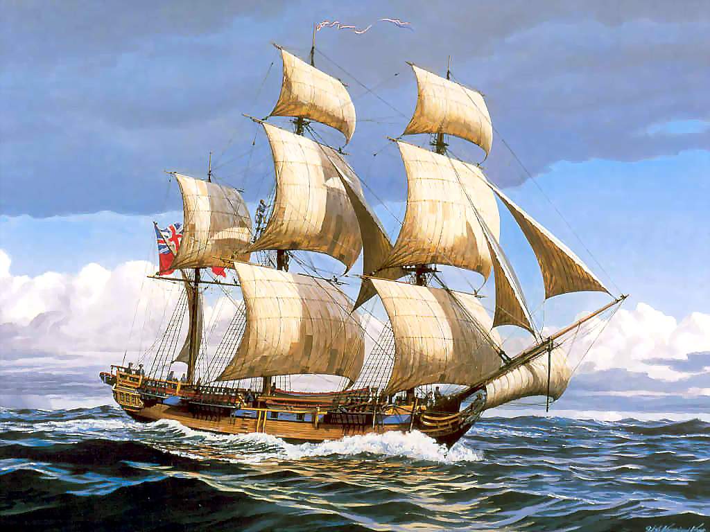
As any area student will tell you, the Puget Sound is named after Peter Puget, who sailed on the HMS Discovery, with Captain George Vancouver. Below is a portion of Puget’s journal, transcribed by local historian and author Steve Lundin. This portion of the journal describes his trip down Totten, Eld, and Budd Inlets. Incidentally, Vancouver anchored Discovery near present day Seattle and sent Puget in command of two rowing craft to survey south, in May and into June, 1792. So, you see, Puget wasn’t in our area with a ship like that depicted in the photo here. The portion of the journal here starts part way down page 197.

[Puget refers to “Friendly Indians” who followed his boats near Nisqually Flats.] They did not leave us to after we had passed the SSW Channel and still conducted themselves in the most inoffensive and peaceable Manner — by Noon we had reached the Continental Shore that now trended about West and pursued it for Ten Miles to an Island where we were glad to stop and erect our Tents to avoid a threatening Squall from the SE about two it came on with Thunder Lightning and a heavy Gust which continued without Intermission all the Afternoon The Rain fell in perfect torrents; we therefore were obliged to remain in our Quarters Till Next Morning Thursday May 24th.

We again set out Early and pursuing the Continent which now trended to the Northward of West by 8 we had determined the termination of this Branch about 12 Miles from Wednesday Island [probably Herron Island in Case Inlet], here we tryed the Seine and caught only one Salmon trout. from this termination we entered another Branch trending in a SW and Southerly and in various Directions [Pickering Passage, between Harstine Island and the Olympic Peninsula] but not more than 1/4 or 1/2 a Mile Broad we continued on till 6 in the Evening when we brought too for the Night and dinner, from this Situation we could see a Channel to the SE [either Peales Passage or Squaxin Passage] by which we hoped to return into the Main Branch through an Opening in the Opposite Shore where the last Canoes had left us.

Early Next Morning Friday May 25th we had a Survey on the Provisions which we found would last till Wednesday next. I therefore thought it best to determine this alternative Navigation and save the trouble of a Second Expedition to this Extent [page 198] We had likewise been successful in procuring a good Quantity of Clams which with Nettle tops Fat Hen and gooseberry Tops greatly assisted the customary allowance of Provisions and Yesterday during a hard Shower of Rain we were particularly fortunate in that Respect — — for the Boats could have loaded with the former, and the People were not averse to eating Crows of which we could always procure plenty. Therefore, as our continuance out could not be attended with any Inconvenience, but would be saving time, We pursued our Examination of the Southern narrow Inlet [Totten Inlet] the termination of which we sounded out by Noon — In this Branch were many beautiful Spots the Low Surrounding country though thickly covered with Wood had a very pleasant Appearance, now in the height of Spring. We had already passed during this Expedition several Small deserted Villages which were supposed to be only the temporary Habitations of Fishermen, we took advantage of the Remaining part of the Tide to come down as far as possible and about five Miles from the termination stopped to Dine

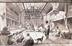
In the Evening we were fortunate in reaching the SE passage seen from last Nights Sleeping Place where we pitched out Tents in a very pleasant Situation; Early next morning Saturday May 26th with a continuance of favorable Weather we pursued another Small Branch [Eld Inlet] that nearly ran parallel to the one we had determined yesterday. About an Hour after we had set out, An Indian Village made it Appearance from whence some Canoes came off perfectly unarmed He pointed that we were near the Termination of this Arm, which Intelligence we found true; In our Way down we landed for a Short time and were received by the Inhabitants with all the Friendship and Hospitality we could have expected — These people I should suppose were about Sixty in Number of all Ages and Descriptions they lived under a Kind of Shed open at the Front and Sides. The Women appeared employed in the Domestic Duties such as curing Clams and fish, making Baskets of various Colours and as nearly woven that they are perfectly watertight. The Occupations of the Men I believe consists chiefly in Fishing, constructing Canoes and performing all the Labourious Work of the Village; Though it was perfectly Curiosity which had induced us to land, yet that was the sooner satisfied by the horrid Stench which came from all parts of these Habitations, with which they were delighted.

The Natives had but Two Sea Otter Skins which were purchased and a variety of Marmot, Rabbit Raccoon Deer and Bear skins were also procured The Men had a War Garment on, it consisted of a very thick Hide supposedly made from the Moose Deer, and well prepared — I have no doubt but it [page 199] is a Sufficient Shield against Arrows, though not against Fire Arms The Garment reaches from the Shoulders down to the Knees, this however was got in exchange for a Small piece of Copper, from which we may suppose they were not of much Value, they likewise disposed of some well constructed Bows and Arrows, in Short it was only to ask, and have your Wish gratified, the only Difference, I perceived between our present Companions and former Visitors, were the Extravagance with Which their Faces were Ornamented. Streaks of Red Ochre and Black Glimmer, were on some, others entirely with the Former, and a few that gave the Preference to the Latter — ever Person had a fashion of his own, and to us who were Strangers to Indians, this Sight conveyed a Stronger Force of the Savageness of the Native Inhabitants, then any other Circumstance we had hitherto met with; not but their Conduct, friendly and inoffensive, had already merited our warmest Approbation, but their Appearance was absolutely terrific. And it will frequently occur, that the Imagination receives a much greater Shock by such unusual Objects, than it would otherwise would, was that Object divested of its Exterior Ornaments or Dress, or the Sight was more familiarized to People in a State of Nature and Though we could not behold these Ornaments with the same satisfactory Eye as themselves, yet in receiving the looking Glasses, each appeared well Satisfied with his own Fashion, at least the Paint was not at all altered. — They likewise had the Hair covered with the Down of Birds; which certainly was a good substitute for Powder, and the Paint only differed in the Colours and not the Quantity used by our own Fair Country women — In those two Instances we meet with some Resemblance to our Customs and I believe the above mentioned Ornaments were of a Ceremonious Nature for our Reception at the Village — —

From Friendly Inlet we pulled up another [Budd Inlet] in the same Direction and landed not far from its termination to Breakfast whither the Indians from the last Arm had followed us. here they made Signs, that this Branch was the Same as their own, which after a Quarter of an hours Row we found to be the case.

Steve Lundin is a long-time resident of the Griffin community located in northwest Thurston County. He received a B.A. degree from the University of Washington and a J.D. degree from the University of Washington Law School and recently retired as a senior counsel for the Washington State House of Representatives after nearly 30 years.

He is recognized as the local historian of the Griffin area and has written a number of articles on local history and a book entitled Griffin Area Schools, available from the Griffin Neighborhood Association at a cost of $10.

Lundin also wrote a comprehensive reference book on local governments in Washington State entitled The Closest Governments to the People – A Complete Reference Guide to Local Government in Washington State. The book costs $85, plus shipping and handling. It is available on the web from the Division of Governmental Studies and Services, Washington State University, or from WSU Extension.

If you have old historic photos of the Griffin area, or family stories of the old days in the Griffin area, please contact Steve Lundin at s.lundin@comcast.net. Steve is most interested in photos of the old two-story Grange Hall in the Griffin area and the old Schneider’s Prairie schoolhouse that burned to the ground in 1926.

Schneider Prairie History

Konrad Schneider is the namesake of Schneider Prairie. Although Schneider was a early settler in the Griffin area, he was not the first white settler of what became known as Schneider Prairie.

Schneider Prairie is one of several oak prairies that existed in Thurston County. Oak prairies were very important to Native Americans. They periodically burned the underbrush on these prairies to keep them open, which attracted deer that were hunted. Native Americans also harvested camas, berries, and acorns on the prairies.

Early white settlers sought these prairie areas for their land claims. Prairies were desirable since they were already cleared to a substantial extent and had relatively good soils.

Puffer and Cross

Two early white settlers filed separate donation claims for the same 160 acres of land on Schneider Prairie. Griffin School, the old Haller mink farm, the Grange Hall, the golf driving range, and the Island Market are located on this claim.

The northern boundary of the claim was about where the Prosperity Grange Hall is located, and where Sunrise Beach Road enters Steamboat Island Road. The eastern boundary was approximately where Mink Street first meets Sunrise Beach Road. The southern boundary was located on about 33rd Street. The claim had about 150 feet of frontage on Eld Inlet. The western boundary was west of the freeway overpass over Highway 101.

William W. Puffer may have been the earliest white settler on Schneider Prairie. He filed a donation land claim for this acreage on April 17, 1855. Field notes from the original survey of the Griffin area on August 4, 1855 noted Puffer’s land claim, with 10 acres under cultivation, and a house. The house was located at about the corner of Sexton Road and Steamboat Island Road. The cultivated area was west of the cabin. However, the Puffer claim was not successful.

Benjamin Franklin Cross filed a claim for the same land on August 26, 1855. Interestingly, Puffer attested on April 17, 1856, that Benjamin Cross had resided on the claim since August 24, 1854. Cross was born in New Hampshire in 1832. He was a resident of Sawamish (Mason) County at the time of filing his claim. An affidavit by Cross indicated that he was single, had arrived in Washington Territory on November 3, 1853, and had first settled on the land claim on August 26, 1854. A 1858 survey of the area noted that Cross resided in the former Puffer cabin.

The original 1855 survey of the Griffin area noted two white (Gerry or Oregon) oaks, 18 inches in diameter, to locate a section boundary line cutting across the property. These markers are called “bearing trees”. One, known as the historical Schneider Prairie Oak Tree, still stands, and currently has a diameter of 60 inches. It is located west of the old barn on Schneider Prairie. Only a stump remains of the second bearing tree.

Cross sold his donation land claim to Eli Montgomery in 1862. Previously, Montgomery acquired a donation land claim for property located on the southeast portion of Mud Bay. He also acquired 33 acres of waterfront land west of the Cross donation land claim on the dead-end portion of what is now Madrona Beach Road. Montgomery sold the Cross donation land claim, and the 33 acre parcel, to Konrad Schneider in 1866.

Schneider and Solbeck

Konrad Schneider was born in 1818 in Hessen, which is now part of Germany. His wife (Albertina) was born in Sweden in 1830. They met and were married in Burlington, Iowa, in 1852, and soon left for Puget Sound in a covered wagon.

Schneider was a stone mason and had been awarded a contract to build a lighthouse at Dungeness near Port Townsend. They arrived in Tumwater in the fall of 1852. Schneider acquired a donation land claim for land located on what is now Case Road, south of the Olympia Airport and north of Millersylvannia State Park.

Konrad and Albertina had nine children — Henry (born in 1853), August (born 1855), Catherine (born 1857), Molkina (born 1859), Frederick (born 1862), Konrad (born 1864), Matilda (born 1867), William (born 1871), and Albert (born 1874). Many of their descendants still live in Thurston County.

Konrad Schneider built the first bridge across the Deschutes River in Tumwater. He also “built or cut” a trail from McLane Crossing on the west bank of Mud Bay out to his property on what became known as Schneider Prairie. Presumably, much of this trail followed the northern portion of an old Indian trail from Black Lake to the southwest shores of Mud Bay. McLane Crossing is near the junction of MacKenzie Road and Delphi Road.

Konrad Schneider acquired additional acreage south and west of the Cross donation land claim, including a homestead of 107 acres in 1882, up what is now called Whittaker Road. The family referred to this valley as Schneider’s valley. A short poem about this land was often recited at family gatherings — “I’ll rally, rally. Everybody’s happy in Schneider’s Valley.”

August Schneider purchased property in 1878 located south of the Cross donation land claim along Eld Inlet, extending south to where the old Ellison Oyster Company was located. A few months later, August sold this property to his sister Molkina, who was married to Swan Solbeck. Swan Solbeck was enumerated as being a farmer on this property in the 1880 Territorial census. A rock quarry was operated on the Solbeck property, beginning in at least 1889. Rock was taken down to Eld Inlet where it was hauled away by barge. This quarry operation lasted for decades. Remnants of the quarry can be seen on the tall rock bluff that is located west of Highway 101, just south of the entry to the highway from the Griffin community, off what is called Old Highway 101.

The Schneider family was enumerated in the 1871 and 1873 Territorial censuses in the Griffin area. However, his sons Henry and August are enumerated separately in the 1880 Territorial census as living in the Griffin area. Konrad is listed with his son Henry. This may mean that Albertina was residing on property located on the west side of Budd Inlet, near the old lumber mill, on what is now Westbay Drive. These holdings included considerable acreage on the top of the hill to the west where the family had an orchard.

Konrad Schneider sold two acres of land to Schneider Prairie School District in 1885. This land was located about where what is now Whittaker Road meets Highway 101, south of the overpass across Highway 101. A schoolhouse was constructed at this site to accommodate an increased number of students attending school in the Griffin area. Originally, school was held in the John Olson cabin, located in what is now Holiday Valley Estates. The children of John and Elizabeth Zandell, and Thomas and Mary Kearney, attended school in the Olson cabin. The Zandells and Kearneys owned land claims on Oyster Bay, west of the Olson land claim. A larger school facility was needed when the children of Swan and Molkina Solbeck became of school age.

Konrad Schneider died in 1903. His heirs sold their interests in his Griffin-area property to his son-in-law and daughter, Swan and Molkina Solbeck. The Solbecks sold their Griffin-area holdings to Judge Arthur E. Griffin and Gabrielle Griffin in 1918.

The Schneider Prairie schoolhouse burned to the ground in the summer of 1926. Children in grades 5 through 8 attended school in the old, two-story Prosperity Grange Hall located on the site of the current Grange hall. Children in grades 1 through 4 attended school in the old Frye Cove School District schoolhouse, which was reopened. This abandoned schoolhouse was located near what now is Gravelly Beach Road, at the top of the hill, west of the Griffin fire station at the corner of Gravelly Beach Loop and Young’s Road. The Griffins essentially gave the school district a new five acre school site, where Griffin School is now located, by exchanging this property for the two acre lot where the old schoolhouse was located. Schneider Prairie School District was renamed the Griffin School District in honor of this generous act. A new, brick schoolhouse was build on the new school district property. The new facility opened in the spring of 1927.

— STEVE LUNDIN
Copyright 2008 by Steve Lundin

Steve Lundin is a long-time resident of the Griffin community located in northwest Thurston County. He received a B.A. degree from the University of Washington and a J.D. degree from the University of Washington Law School and recently retired as a senior counsel for the Washington State House of Representatives after nearly 30 years.

He is recognized as the local historian of the Griffin area and has written a number of articles on local history and a book entitled Griffin Area Schools, available from the Griffin Neighborhood Association at a cost of $10.

Lundin also wrote a comprehensive reference book on local governments in Washington State entitled The Closest Governments to the People – A Complete Reference Guide to Local Government in Washington State. The book costs $85, plus shipping and handling. It is available on the web from the Division of Governmental Studies and Services, Washington State University, or from WSU Extension.

This is part of a short series of papers on local history. The first of this series was published last month. Click here to read “Griffin Historical Sketch.”

If you have old historic photos of the Griffin area, or family stories of the old days in the Griffin area, please contact Steve Lundin at s.lundin@comcast.net. Steve is most interested in photos of the old two-story Grange Hall in the Griffin area and the old Schneider’s Prairie schoolhouse that burned to the ground in 1926.
Griffin Historical Sketch

Tcover13he Griffin community is located in northwest Thurston County and occupies the Steamboat Island peninsula that extends northward into southern Puget Sound.

The history or the Griffin community falls into three distinct periods.

The first period was the history of indigenous peoples before contact with white people. Indigenous peoples inhabited Puget Sound for thousands of years before the arrival of white people. They were known as the “People of the Water” and considered Puget Sound to be a sacred place. They relied the Sound their basic means of transportation and as a source of food, including clams, oysters, and salmon.

Separate, but closely related, bands of indigenous peoples inhabited the seven inlets of southern Puget Sound. Each band occupied the watershed of the inlet – both sides of the inlet, including the Squi-Ailt who occupied the Eld Inlet watershed and the T’Peeksin who occupied the Totten Inlet watershed.

During cold weather, members of a band occupied cedar long houses in a village located at the sheltered end of each inlet. Remains of a large long house have been found on former Secretary of State Ralph Munro’s property located on the eastern shore of Mud Bay at the southern end of Eld Inlet. During warm weather, families units from each band fanned out along both sides of their inlet and lived in less permanent dwellings.

The second period involved the arrival of white people and their early interactions with indigenous peoples. These interactions had calamitous consequences with large numbers of native peoples losing their lives to disease brought by white men.

The first whites arriving in the Puget Sound area included Captain Vancouver, Peter Puget, and Captain Gray. Peter Puget explored the southern portion of Puget Sound in 1792. He named many areas which remain as local place names, including Eld and Totten Inlets. His journal describes indigenous peoples as being friendly and hospitable.

The United States and Great Britain jointly occupied what was called Old Oregon Country from 1818 until 1846 without consulting the indigenous peoples of this area. The Hudson Bay Company opened Fort Nisqually on southern Puget Sound in 1833. Michael T. Simmons and George W. Bush led the first American settlers on Puget Sound, arriving at what became Tumwater in 1845. A Treaty of 1846 ended the Joint Occupancy and established the western boundary between Canada and the United States. Congress created Oregon Territory in 1848 from the American portion of what remained of Old Oregon Country. The Oregon Territorial Assembly created Thurston County in 1852. Congress created Washington Territory out of the northern portion of Oregon Territory in 1853.

Newly appointed Governor Isaac I. Stevens negotiated a number of treaties between the United States and indigenous peoples in Washington Territory. This included the Medicine Creek Treaty of 1854 that was signed by Governor Stevens and representatives of various tribes and bands of indigenous peoples living on southern Puget Sound. Indigenous peoples ceded 4,000 square miles of land in return for three small reservations and the right to fish “at all usual and accustomed grounds”. The Squaxin Tribe was recognized as a combination of the bands of indigenous peoples living on the seven inlets in southern Puget Sound, including the Squi-Ailt and T’Peeksin bands. Many indigenous peoples moved to a reservation located on Squaxin Island but most soon left as the Island had no source of drinking water. They supported themselves by logging, working on hop and berry farms, and harvesting shellfish and fin fish.

Early white settlers in the Griffin area were William W. Puffer and Benjamin F. Cross. Puffer filed a donation land claim in the early 1850’s for 160 acres of land on what became known as Schneider’s Prairie. He lived in a cabin was located near the current intersection of Sexton and Steamboat Island Road, north of the Highway 101 overpass. Puffer’s claim was rejected by the federal government. Then Benjamin Franklin Cross filed a claim for the same 160 acres. Other white people soon filed claims or purchased earlier land claims, including August and Konrad Schneider after whom the local prairie is named.

The third period is the modern period since the early interactions between white settlers and indigenous peoples. Many settlers and new comers moved into the Griffin area during this period. The Griffin community was transformed from rural settlements of whites and indigenous peoples into a suburban area with many residents commuting to work outside of the peninsula.

Thurston County remained as the local government providing governmental services and facilities in the Griffin area. This included a system of road, law enforcement, a court system, and public health regulation. Early roads were provide by the forced labor of adult males and property owners using a system of small road districts.

Thurston County created a system of public schools throughout the county. Mud Bay School District was formed around 1870 and served all of the northwestern portion of the county, including the Griffin community. The first schooling in what is now the Griffin community was in the late 1870’s at the log cabin of John and Ella Olson, located in what is now called the Holiday Valley Estates. Schneider’s Prairie School District was created out of part of Mud Bay School District in 1881. A schoolhouse was soon constructed at what is now the north end of Whittaker Road immediately south of the Highway 101 overpass. Territory was gradually removed from Schneider’s Prairie School District to create a number of new districts — Hunter Point School District at the north end of the Griffin peninsula in 1891, John Fry School District at the middle portion of the peninsula in 1891, and Oyster Bay School District at the southwest portion of Schneider’s Prairie School District in 1907.

These new districts were eventually reunited with Schneider’s Prairie School District, which was renamed as the Griffin School District. Oyster Bay School District consolidated with Schneider’s Prairie School District in 1922. John Fry School District consolidated with Schneider’s Prairie School District in 1923. The Schneider’s Prairie schoolhouse burned to the ground in the summer of 1926. Arthur Griffin owned considerable acreage on Schneider’s Prairie. He gave the school district five acres of land in exchange for the two acre site where the burned schoolhouse was located and the school district was renamed in his honor. A new brick schoolhouse opened at the new school property in the Spring of 1927. Hunter Point School District consolidated with Griffin School District in 1934.

Griffin School has changed since its early days. A new 12-classroom facility opened in 1969 and the old 1927 building was torn down. A middle school complex was added in 1978. Additional classrooms, and a gymnasium, music room, kitchen and cafeteria were added in 1989. A major remodeling project was completed in 2004.

Griffin Fire District (Thurston County Fire District No. 13) was created in 1962 to provide fire protection and emergency medical services in the Griffin area.

The county operates a public park at Frye Cove off of Young’s Road. Griffin School District and the county jointly provide additional facilities off of 41st Street.

Employment in the Griffin area during the early years of the modern period was based upon logging, farming, oyster growing, working on steamships, and working at local commercial enterprises. Major logging camps and logging rail roads at one time served the Griffin community and nearby area. Major shellfish harvesting operations also were located on both Oyster Bay and Mud Bay. These operations remain today, although the Olympia oyster is no longer the primary shellfish that is harvested. Somewhat large farming operations were located in the Griffin area at one time. Modern farming is much less substantial. A number of local businesses provide employment and services. Most residents now commute out of the Griffin area for their employment.

The Squaxin Tribe emerged as a major economic and cultural presence in the Griffin area during this period.

— STEVE LUNDIN
Copyright 2008 by Steve Lundin

Steve Lundin is a long-time resident of the Griffin community located in northwest Thurston County. He received a B.A. degree from the University of Washington and a J.D. degree from the University of Washington Law School and recently retired as a senior counsel for the Washington State House of Representatives after nearly 30 years.

He is recognized as the local historian of the Griffin area and has written a number of articles on local history and a book entitled Griffin Area Schools, available from the Griffin Neighborhood Association at a cost of $10.

Lundin also wrote a comprehensive reference book on local governments in Washington State entitled The Closest Governments to the People – A Complete Reference Guide to Local Government in Washington State. The book costs $85, plus shipping and handling. It is available on the web from the Division of Governmental Studies and Services, Washington State University, or from WSU Extension.

If you have old historic photos of the Griffin area, or family stories of the old days in the Griffin area, please contact Steve Lundin at s.lundin@comcast.net. Steve is most interested in photos of the old two-story Grange Hall in the Griffin area and the old Schneider’s Prairie schoolhouse that burned to the ground in 1926.